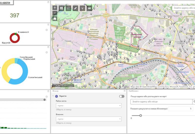
Specialists of the World Data Center of Geoinformatics and Sustainable Development (WDC-Ukraine) prepared a dashboard based on the interactive map with shelter addresses for the population of Kyiv. The scientists posted it on the website of the Kyiv City State Administration. The dashboard allows everyone to explore the closest shelters within a given radius. One can also list the nearest asylums by different types, availability, ramps availability, and others.
On the dashboard, one can explore the area in the type of a topographic map, TopOSM, and space image. One can also measure the distances between objects and filter shelters by area and owner.
We recommend everyone find out the nearest shelters in advance and plan ways to access them. However, the dashboard developers sincerely hope that the situation when this application will be necessary can be prevented.
You can find more details about the dashboard at the link
Vadym Kondratiuk, Vice-Rector for Administrative Affairs of Igor Sikorsky Kyiv Polytechnic Institute, spoke about the staffing and compliance with the norms of shelters on the Igor Sikorsky Kyiv Polytechnic Institute Campus.
Also, the Director of the Dormitory Campus Oleksandr Ishchenko reported on the condition and readiness of shelters on the campus.

