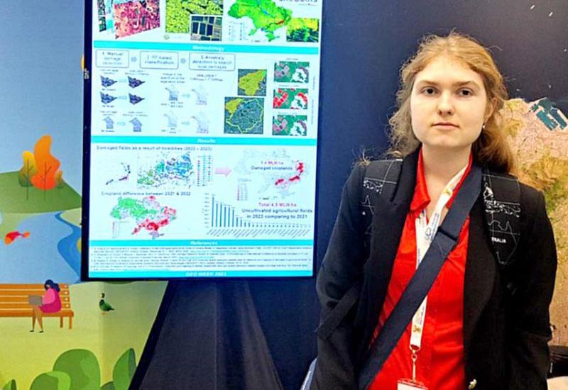
The scientific space of Kyiv Polytechnic is expanding its horizons: Sophia Drozd, a master's student of the Department of Mathematical Modeling and Data Analysis at the School of FTI, working under the supervision of the Head of the Department, Professor Natalia Kussul, successfully presented Kyiv Polytechnic on the African continent.
At the summit, the student is an active participant in the department's projects in the field of artificial intelligence for analyzing and processing geospatial data. She is engaged in satellite monitoring of the agricultural sector, including the recognition of war-damaged fields using computer vision, and is also working on modeling smart cities and villages using artificial intelligence. In addition, Sofia has won awards at student research competitions and regularly participates in international scientific conferences.
In November of this year, she represented Europe and Igor Sikorsky Kyiv Polytechnic Institute as a member of the European Union delegation at the ministerial summit with the participation of more than 150 countries and the international conference GEO Week 2023 in Cape Town (South Africa). The summit was devoted to discussing the development strategy of the Earth Observation Group (GEO) after 2025. According to this strategy, the next decade in GEO will be devoted to the development of artificial intelligence based on geospatial data under the slogan "Earth Intelligence for All".
"For the first time, the GEO Summit discussed the role of youth in creating Earth Intelligence and presented the first ever GEO Youth Declaration," said Sofia. She participated in the development and presentation of the declaration to the ministers of GEO member countries and spoke at the plenary session, where she presented the position of young participants on the GEO post-2025 strategy and confirmed that young people involved in the GEO community support this strategy.
In addition, Sofia presented the results of research conducted at the department on the use of machine learning to monitor land cover and land use changes in Ukraine. However, the demonstration of the achievements of the MMAD Department to the scientific community was not limited to this. Two papers were presented at the EuroGEO booth: one on forest monitoring using intelligent models on satellite data within the Horizon Europe project "Satellites for Wildlife and Forest Threat Tracking (SWIFTT)", and the other on the methodology for recognizing war-related damage to agricultural fields in Ukraine using Earth observation data.
"It is important that the strategic direction of GEO, aimed at the development of artificial intelligence, Earth Intelligence, is central to the research and educational program of our department. We are happy for our students who successfully represent their work and Ukraine at the international level," says Professor Nataliia Kussul.
Students. The department is deservedly proud of the success of its students, both current and former. In particular, Mykola Lavreniuk, a graduate student of the Department of MMAD, the first PhD in Igor Sikorsky Kyiv Polytechnic Institute, a specialist in machine learning and satellite intelligence, a senior researcher at the Department of Space Information Technologies and Systems of the Institute of Space Research of the National Academy of Sciences of Ukraine and the State Space Agency of Ukraine, was recognized as one of the 20 best young scientists of the National Academy of Sciences of Ukraine in 2023. Mykola's research focus is on deep learning methods for geospatial data. He is an active participant and leader of many national and international projects, the results of which are published in highly rated international journals and presented at international conferences.
Publications. Of course, machine learning and artificial intelligence methods developed at the department are used to solve important applied problems. For example, the Department's researchers and students have recently published an article co-authored with colleagues from the EC Joint Research Center and the World Bank Ukraine on a methodology for recognizing war-related damage to agricultural fields in Ukraine based on open satellite data using machine learning. This methodology allowed us to determine that about 1.5 million hectares of agricultural land in Ukraine have been directly damaged during the year and a half of war. The classification accuracy is about 90%. The article was published in the International Journal of Applied Earth Observation and Geoinformation, which is in the highest Q1 quartile of the impact rating of scientific publications.
Recently, the journal of the publishing company "Nature" published an article in which the department's professors discussed the impact of the war on the preservation of protected areas. It is shown that during the period of Russian aggression from 2014 to 2020, 25% of the forest belonging to the Emerald Network, which is protected by UNESCO, was destroyed in the occupied territory of Luhansk region. At the same time, these unique forests are preserved on the territory controlled by Ukraine. "The methods of computer vision and deep learning developed at the department were used to analyze the environmental situation in the war zone and the occupied territories. The study was conducted by an international team of scientists with the participation of faculty and graduates of the department who are currently working at the University of Maryland on NASA projects," the authors of the study said.
About the future. As you can see, the Department of MMAD conducts research, the results of which are in demand by the scientific community, the government and the public. Favorable conditions have been created here for the development and formation of young researchers, which is a solid foundation for their further growth and recognition. "We are not only proud of our graduates, but also invite ambitious people to apply to our postgraduate program in Applied Mathematics, as well as to bachelor's and master's degree programs," Natalia Kussul addresses everyone.
For reference: : GEO – is a global network that brings together government, academic and research institutions, scientists and experts to create innovative solutions for sustainable human development and environmental management. Ukraine is also part of this community.

